Updated August 2026
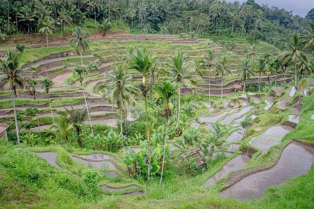
Tegallalang rice terrace
An amphitheatre of narrow paddies twenty minutes north of Ubud. You pay at the gate, and then you pay again on the way down, which is the part nobody mentions before you go.
Photo Philip Nalangan, CC BY 4.0
Tegallalang is a narrow valley on the road north out of Ubud where the paddies have been cut into both slopes in tight curved steps, so the whole hillside reads as one continuous piece of geometry. It is a working farm rather than a park, irrigated by the same cooperative water system that has organised this island for a thousand years, and it is twenty minutes from the centre of town.
It is also the most commercially developed rice field in Indonesia. There is a ticket gate, a row of cafés along the rim, swings, photo nests, costume rental, and a series of informal payment points scattered down the paths. Every one of those exists because roughly a million people a year come to photograph somebody else’s rice.
None of that makes it a bad visit. It makes it a visit with a right answer and a wrong one, and the two variables that decide which you get are the hour you arrive and the month you come in. This page takes both apart, along with the question that fills the review pages: how many times you are actually going to be asked for money.
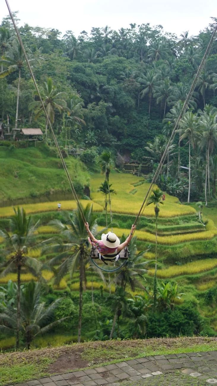
Terraces, swing and temples in one morning
Free cancellationTegallalang and Ubud day trips
- ✓Hotel pickup in Ubud or the south, which solves the return journey the terraces are famous for making difficult
- ✓The driver waits, so the descent into the valley is not on a clock
- ✓Usually bundled with Tirta Empul, a waterfall or a coffee plantation on the same road north
- ✓Swing entry is normally a paid add-on rather than included, so check the listing before you book
Affiliate link. Booking through GetYourGuide costs you nothing extra and supports the guide. Prices are indicative and vary by option and season.
The verdict in 30 seconds
- Arrive before eight, or do not bother. The coaches turn the descent into a queue by mid morning.
- Bring a thick stack of small notes. The gate is the first payment, not the only one, and nothing takes a card.
- It is a climb, not a viewpoint. Steep, muddy, unshaded steps down and back up again.
- Green is not guaranteed. Two harvests a year mean the valley can be gold, flooded or cut to stubble.
- It is not the UNESCO site. That is Jatiluwih, ninety minutes west.
What you are actually looking at
Before the practicalities, the thing itself, because it is more interesting than the swing photographs suggest.
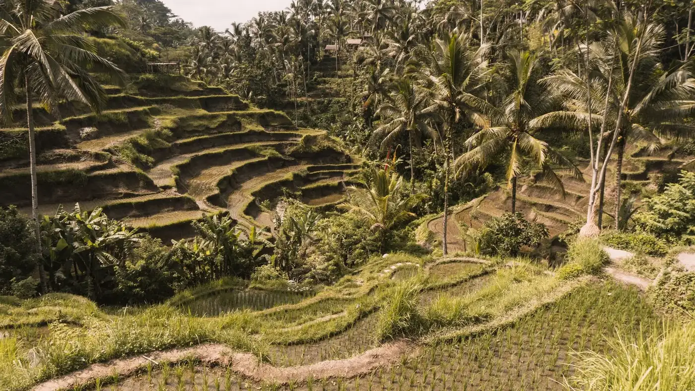
The valley is narrow and steep, perhaps a couple of hundred metres across at the wide point, with a stream at the bottom and terraces climbing both sides. That tightness is the whole reason Tegallalang photographs the way it does: on a broad plain you would see fields, but here the steps stack up in your field of view and you read fifty levels at once.
Locally the viewpoint stretch is called Ceking, which is why some maps, tickets and search results use that name instead. It is the same place. The terracing itself is old, built and rebuilt by hand, and the retaining walls are packed earth rather than stone, which is why they need constant repair and why the family that farms a plot cares who walks on their ridge.
The coconut palms scattered through the terraces are not decoration either. They mark plot boundaries, hold the earth on the steepest walls and belong to whoever owns the ground under them. They are also, incidentally, the reason the light in the valley is so uneven after about nine in the morning.
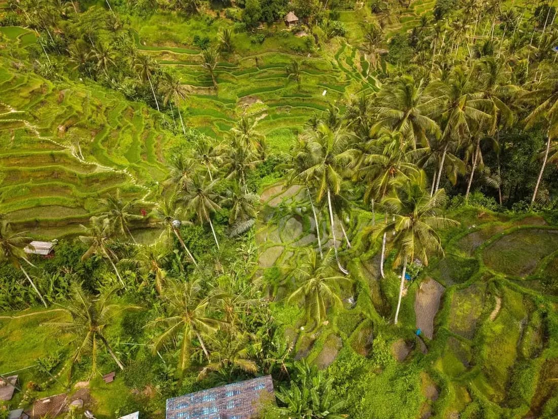
From above, the logic becomes obvious: water enters at the top and falls plot by plot to the stream, and every level depends on the one before it.
Subak, and why it matters here
The water arrives through subak, a cooperative irrigation system documented on Bali since the ninth century. A subak is not a piece of plumbing, it is an association: the farmers sharing one water source meet, agree who floods when, maintain the channels together and settle disputes at a water temple rather than in an office. Because water reaches the lowest terrace only by passing through every terrace above it, nobody can take more than their share without the whole valley noticing.
That system is why Bali could grow rice on a volcanic slope at all, and it is why the terraces look organised rather than merely picturesque. If you want to see the religious half of the same machine, the spring temple at Tirta Empul sits on the same road and is fed by the same watershed.
Tegallalang is not the UNESCO site
The 2012 World Heritage inscription is the Cultural Landscape of Bali Province, and like every inscription it covers a defined list of component sites: the Pakerisan watershed with its temples, the Batukaru area, the royal water temple of Taman Ayun, and the terraces at Jatiluwih. Tegallalang is not among them. It is farmed with subak, as most of Bali is, which is not the same thing as being inscribed. Tour listings, aggregator pages and a good number of guidebooks say otherwise, and they are wrong.
Every payment, decoded
“Do you have to pay to go to Tegallalang?” is one of the two most searched questions about the place, and the reason it keeps getting asked is that the honest answer is not a number. It is a sequence.
The entrance fee is small and posted. What is not posted is everything after it. As you walk down into the valley you cross land belonging to different families, plot by plot, and at intervals somebody will be sitting beside the path with a box. Depending on your route there may be two of these, or six. This gets written up online as a scam roughly once a week, and it is not one, but the criticism that does land is that nothing is priced in advance, so you cannot know what your walk will cost until you have finished it.
Every hand that will be held out
Six separate payments exist at Tegallalang and only two of them are the ticket. Tap each one to see who is asking, whether it is legitimate, and how to say no without an argument.
- Who is asking
- The family that farms the plot you are about to cross, often an older woman with a box
- What it buys
- A wooden box, sometimes a handwritten sign saying donation, sometimes just a person waiting. There may be two of these on a short loop and five or six if you cross the valley floor and climb the far side.
- Is it legitimate
- Genuine, and this is where most of the anger online is misplaced. You are walking on private working farmland, on ridges the family repairs by hand after every rain. Almost none of the gate fee reaches them. The fair criticism is not that they ask, it is that nothing is priced or signposted, so you cannot know what your walk will cost before you start it.
- How to decline
- A small note, a smile and walking on is the normal transaction and it takes four seconds. If you have run out, say so plainly and keep moving; nobody blocks the path. If you do not want the running total at all, turn back before the valley floor.
Everything above is cash, and nothing above takes a card. The single preparation that changes the visit is arriving with a thick stack of small notes rather than one large one, because nobody at a donation post has change and the exchange gets awkward fast.
What the whole thing comes to
Orders of magnitude rather than prices, because everything here is set locally and moves. The useful figure is not any single line, it is the gap between the ticket and the total, which is where the surprise lives.
| What | Detail | Order of magnitude |
|---|---|---|
| Parking | Per vehicle, collected on the road. Usually settled by your driver without asking you. | A couple of euros |
| Entrance ticket | Per person, cash, at the gate on the rim. The only posted price of the day. | ≈ €1 to €2 |
| Donation posts | Each plot you cross in the valley. Two on a short loop, five or six on a full crossing. | ≈ €0.50 each |
| Photo props and nests | Private operators at the scenic bends. Costume sometimes included. | ≈ €3 to €7 |
| The swings | A separate business with its own gate. Harness, several heights, photographer. | ≈ €15 to €30 |
| Driver from Ubud, half day | Enough for the terraces plus one temple or a coffee plantation on the same road. | ≈ €20 to €30 |
Walk the rim, take the photograph and leave, and Tegallalang is one of the cheapest attractions on Bali. Descend to the stream, cross it, climb the far side and ride a swing on the way out, and it quietly becomes one of the more expensive mornings in the Ubud area. Both of those are the same site on the same day.
The practical preparation is unglamorous and it works: decide before you set off how far down you intend to go, carry small notes rather than one large one, and treat the running total as the real price of admission. If that is not how you want to spend a morning, the view from the rim is included with the ticket and is most of the photograph anyway.
Green, gold or bare: the terraces month by month
The second great source of disappointment, and the one almost nobody warns about. Rice is a crop on a schedule, not a permanent green carpet.
Tegallalang runs two harvests a year, so the valley passes through the same sequence twice: flooded and ploughed, then young shoots standing in water, then full green, then gold, then cut to stubble. Turn up in the middle of a harvest and you will find brown steps, drying straw and farmers working, which is a fascinating thing to see and nothing whatsoever like the photograph that brought you.
Nothing on the site warns you about this, no tour listing mentions it, and the photographs used to sell the place are overwhelmingly from the two or three weeks a year when the canopy is at its fullest. That mismatch, far more than the crowds or the fees, is what people are describing when they say Tegallalang did not look like the pictures.
The good news is that the cycle is predictable enough to plan around, and that no stage is actually a bad visit once you know what you are walking into. Flooded terraces reflect. Gold terraces photograph beautifully in low light. Harvest is the only time you see the place doing the thing it exists to do.
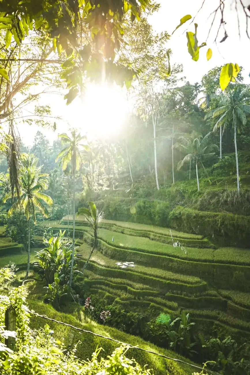
The version everybody comes for: full canopy, low sun through the palms, nobody else on the path. It exists for roughly two hours a day, and only in part of the year.
What the terraces look like when you get there
Rice is a crop, not scenery. Tegallalang runs two harvests a year, so the valley is green, flooded, gold or cut to stubble depending on the month you turn up. Pick yours.
April
Full green- What you see
- The crop is at its tallest and heaviest, leaning in the wind. The narrow ridge paths disappear under the leaves in places.
- The photograph you get
- The classic postcard, and the month the terraces look most like a single living surface.
- Weather and crowds
- Shoulder season and one of the better all-round months to be in Ubud.
One caveat that matters more than the calendar: the plots belong to different families and they do not plant on the same day. There is never one single stage across the whole valley, only a dominant one, and there is almost always a patch of something else in the frame.
If you only care about the green photograph
Aim for February to April, or November for the second crop. Those are the windows when full canopy is most likely across most of the valley. July and August, which is precisely when the island is busiest, are the two months most likely to give you stubble, and that collision explains a large share of the one star reviews.
The hour you arrive decides the visit
Tegallalang is small. A few hundred extra people do not spread out, they queue, because there is exactly one path down and it is one person wide in places.
| Arrival | On the paths | Light and heat | Verdict |
|---|---|---|---|
| 06:00 to 08:00 | A handful of people, mostly photographers and farmers | Low raking light, cool enough for the climb | The right answer, every time |
| 08:00 to 10:00 | Filling steadily, swings start to queue | Still workable, heat building fast | Acceptable compromise if a dawn alarm is not happening |
| 10:00 to 14:00 | Coach hour: two way traffic on a one way path | Flat overhead light, genuinely hot on the climb out | The window that produces the bad reviews |
| After 15:00 | Thinning out as the tours head back | Warm light returning, rain likely in wet season | A decent second choice, with a real chance of a soaking |
Sunrise is overstated
Tegallalang is not really a sunrise site the way Lempuyang is. The valley runs so that the sun comes over the ridge well after it has technically risen, so the first properly good light lands closer to 07:00 than 06:00. Sleeping the extra hour costs you nothing and the crowd still has not arrived.
Why afternoon rain matters more here
The paths are packed earth on the edge of flooded plots. Twenty minutes of rain turns the descent into a slide and the climb out into hard work, and it stays that way for hours afterwards. In wet season this alone is a reason to make Tegallalang the first stop of the day rather than the last.
The walk down, and the walk back up
The single most underestimated thing about Tegallalang. It looks like a viewpoint in the photographs. It is a valley.
From the rim a set of concrete and earth steps drops away towards the stream, then narrows into ridge paths running between the plots. The descent takes fifteen or twenty minutes at a walk. The climb back up the far side takes considerably longer, because it is steep, unshaded and uneven at every step, and because you will be doing it in tropical heat with no water unless you brought some.
The surface is the other surprise. The ridges are earth walls between flooded plots, often no wider than a boot, and after rain they are slick. There are no railings anywhere and there is no lighting. People fall in. It is a soft landing into mud rather than a dangerous one, but it happens several times a morning and usually to somebody wearing sandals.
The reward for doing it is real: the far side is quiet. Most visitors turn round at the first bend below the entrance, so a twenty minute walk buys you a stretch of terrace with nobody on it, at any hour of the day. That is worth more than the swing photograph and it costs a few donation posts.
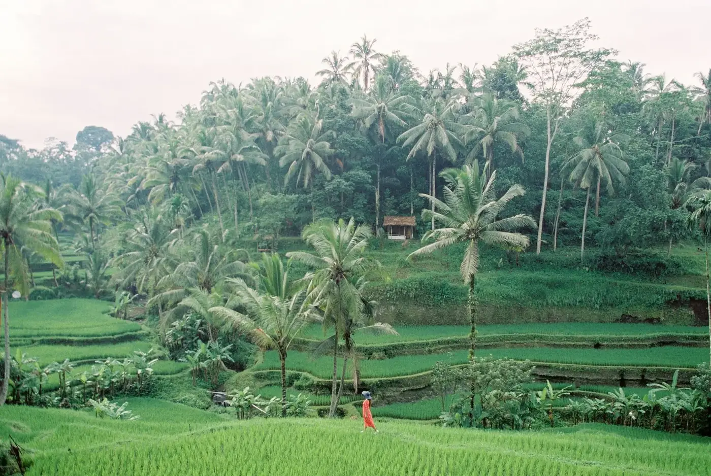
The lower paths, away from the entrance. This is what the extra twenty minutes buys you, and it is what the site looked like before the swings.
Shoes
Trainers or anything with grip. Flip-flops are the standard mistake and they come off in the mud.
Water
Carry it down with you. There is nothing to buy in the valley and the climb out is the thirsty part.
Sun
The terraces are open ground. Hat and sunscreen, or come before the sun clears the ridge.
Mosquitoes
Standing water everywhere, and they are worst at dawn and dusk, which is exactly when you want to be here.
The swings, the nests and the costumes
Second only to the fees as a source of confusion, because visitors reasonably assume the swings are part of the site. They are not.
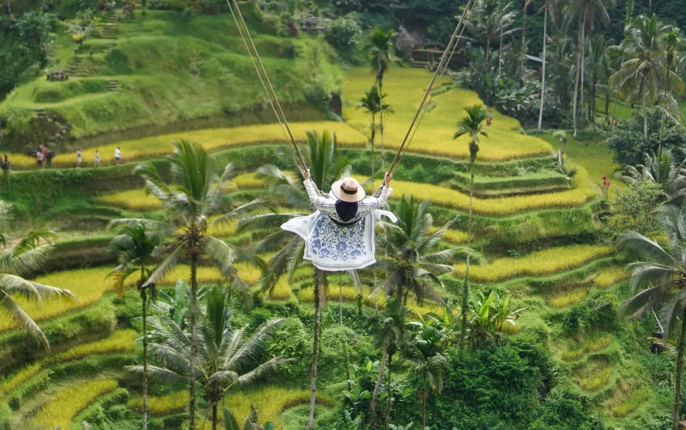
What you are buying
A swing session is a package, not a ride. You get a harness, a choice of swing heights, usually a flowing dress if you want one, and a staff photographer who shoots you on your own phone from the angle that works. The whole thing takes fifteen to twenty minutes and costs several times the entrance fee.
There are multiple independent operators along the same stretch of ridge, and they are not interchangeable: heights, safety kit, the state of the platform and the number of people ahead of you vary a lot. Walk past two before you pick one.
Whether to bother
If the photograph is genuinely what you came to Bali for, it is a clean transaction and nobody should feel superior about it. If you came for the landscape, skipping it costs you nothing at all, and you can see exactly what you are turning down from the path.
The one thing worth knowing in advance: swing entry is almost never included in a Tegallalang tour price. Guided trips take you to the operator and you pay them directly on the spot, which surprises people who assumed the tour covered it.
Photo nests, hearts and platforms
Scattered along the paths you will find bamboo nests, wooden platforms and heart-shaped frames perched over the drop, each with an attendant and a small fee. They are cheaper than the swings and faster, and they are the reason a certain angle of Tegallalang looks identical on ten thousand feeds. Entirely optional, no pressure to use them, and worth exactly what you think they are worth.
Getting there, and getting back
Getting up to Tegallalang is easy from anywhere in the Ubud area. The return leg is the part that catches people out.
| Coming from | Drive | Leave by, for the quiet hour |
|---|---|---|
| Ubud centre | 20 to 30 min | 06:15 |
| Seminyak, Canggu | 1 h 30 to 2 h | 05:00 |
| Kuta, the airport | 1 h 45 to 2 h 15 | 04:45 |
| Kintamani, Mount Batur | 45 min to 1 h | On the way back down |
By scooter
The most flexible option and a straightforward ride up the Kintamani road, which is wide and well surfaced. Park on the road for a small fee. The only caution is the same as everywhere on Bali: an international permit with the right category, or your travel insurance will not look at a claim.
With a driver
A half day driver from Ubud costs less than most people expect and solves the return problem entirely, because the car waits. It also makes the obvious combination possible: terraces at opening, then a temple or a coffee plantation on the same road north.
Grab and Gojek
Fine going up, unreliable coming back. Pickups around the terraces are restricted by local transport co-operatives, so a booking may simply never be accepted. Do not plan a return on the app unless you are prepared to walk down the road first.
The rim: cafés, warungs and the view you do not have to walk for
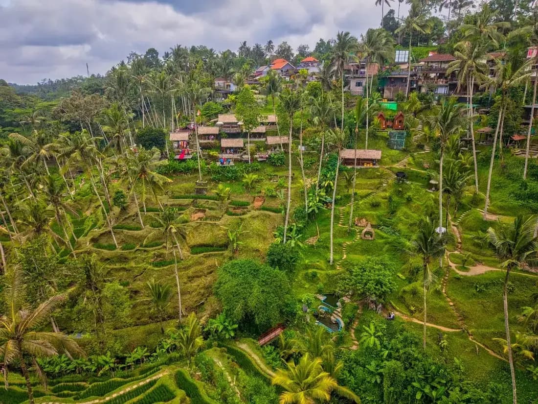
A line of cafés and warungs runs along the road side of the valley, most of them with a deck cantilevered out over the drop. The coffee is expensive by Bali standards and the food is unremarkable, and both of those are beside the point: you are renting a table with a view for an hour. Several of them have a minimum spend rather than menu prices, usually posted at the entrance.
Two things make this genuinely useful rather than a tourist trap. First, some of these places sit outside the ticket gate and let you look at the terraces from their deck without buying an entrance ticket at all, which is a legitimate option if you want the view and not the walk. Second, they are the natural place to sit out the mid morning crush if you arrived early: descend at first light, climb back out by eight, and have breakfast while the coaches unload.
Almost every one of them also sells Luwak coffee, and it is worth saying plainly that the caged civet operations behind that trade are not something to support. The tasting flights on the same road are usually a more honest product than the Luwak cup at the end of them.
Tegallalang or Jatiluwih
The comparison every itinerary eventually runs into, and the two places are far less interchangeable than the listings suggest.
| Tegallalang | Jatiluwih | |
|---|---|---|
| From Ubud | 20 to 30 minutes | 1 h 30 or more, each way |
| Landscape | Narrow, steep amphitheatre. Dramatic, compact, photogenic | Vast open plateau under a volcano. Spacious rather than dramatic |
| Effort | Steep descent and climb, muddy ridges, one hour | Flat marked loops, two to three hours if you want them |
| Crowds | Heavy from mid morning | Light, even in high season |
| Commercial | Swings, nests, costumes, donation posts | One entrance fee, a few warungs, little else |
| UNESCO | Not an inscribed site | A named component of the subak inscription |
The honest verdict: if you are based in Ubud and have one free morning, go to Tegallalang at opening and accept what it is. It is close, it is genuinely striking, and an hour there costs you almost nothing in schedule. If you have a full day, a driver and an appetite for actual walking, Jatiluwih is the better landscape and the quieter one, and it is the site the World Heritage listing is talking about.
What does not work is doing both in one day from Ubud. They sit on opposite sides of the interior and you would spend four hours in a car to see two versions of the same crop.
Building a morning around it
An hour at Tegallalang is not a day out. It is the first stop of one, and everything else worth doing is on the same road.
The classic loop north
Terraces at opening, then Tirta Empul for the purification spring, then back into Ubud for lunch. Both sites are at their best in the first two hours of the day, so the order matters and this is the right one.
With a waterfall
The Tegenungan waterfall sits south east of Ubud and works as the afternoon half of the same day. Terraces early, waterfall when it is hot enough to want to be in the water.
A walking morning in town
If you would rather not get in a car at all, the Campuhan Ridge Walk starts in town, costs nothing and asks nobody for a donation, which after Tegallalang has a certain appeal.
Back in town, Ubud Palace takes twenty minutes in daylight and is worth far more in the evening for the dance performances in the courtyard. The full picture of what fits into how many days is on the Ubud guide.
Practical details
Where
Twenty minutes north of Ubud on the Kintamani road, in Gianyar regency. Also signed as Ceking on some maps and tickets.
Hours
Roughly first light to late afternoon. Not authoritatively posted anywhere, and the rim is walkable before the desk is staffed.
Cash
Everything, and nothing takes a card. Small notes, and more of them than you think you need.
How long
One hour for the rim and a loop into the valley. Add an hour if you are doing a swing or breakfast on the edge.
You are walking on somebody's crop
Every path here runs along the wall of a working plot, and those walls are rebuilt by hand. Stay on the ridges rather than cutting across a flooded field for a photograph, do not climb the retaining walls, and step aside for anyone carrying tools or a load. It reads as basic manners and it is also the difference between a site that stays open to walkers and one that stops being.
Tegallalang: common questions
Is Tegallalang Rice Terrace worth it?
Do you have to pay to go to Tegallalang Rice Terrace?
How long do you need at Tegallalang Rice Terrace?
What should you wear to Tegallalang Rice Terrace?
Is Tegallalang a UNESCO World Heritage site?
What is the best time of day to visit Tegallalang?
Can you walk through the Tegallalang rice terraces?
Are the Tegallalang swings worth it?
Tegallalang or Jatiluwih, which is better?
How do you get to Tegallalang from Ubud?
Is Tegallalang good with children?
What are the opening hours at Tegallalang?
More around Ubud
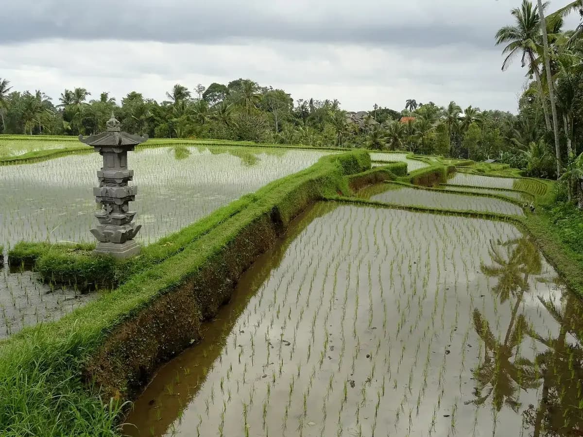
Ubud
How long to stay, what to be careful of, and what is within reach.
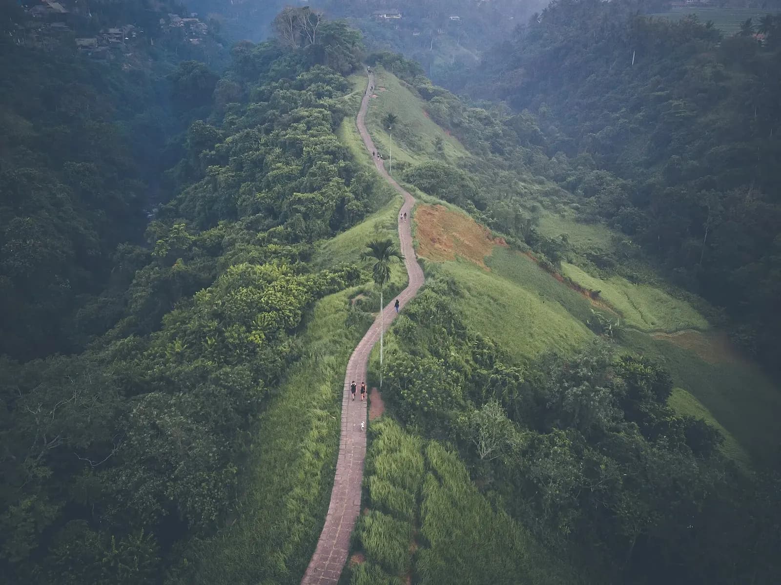
Campuhan Ridge Walk
The free ridge trail that starts in town, and where the trailhead is.
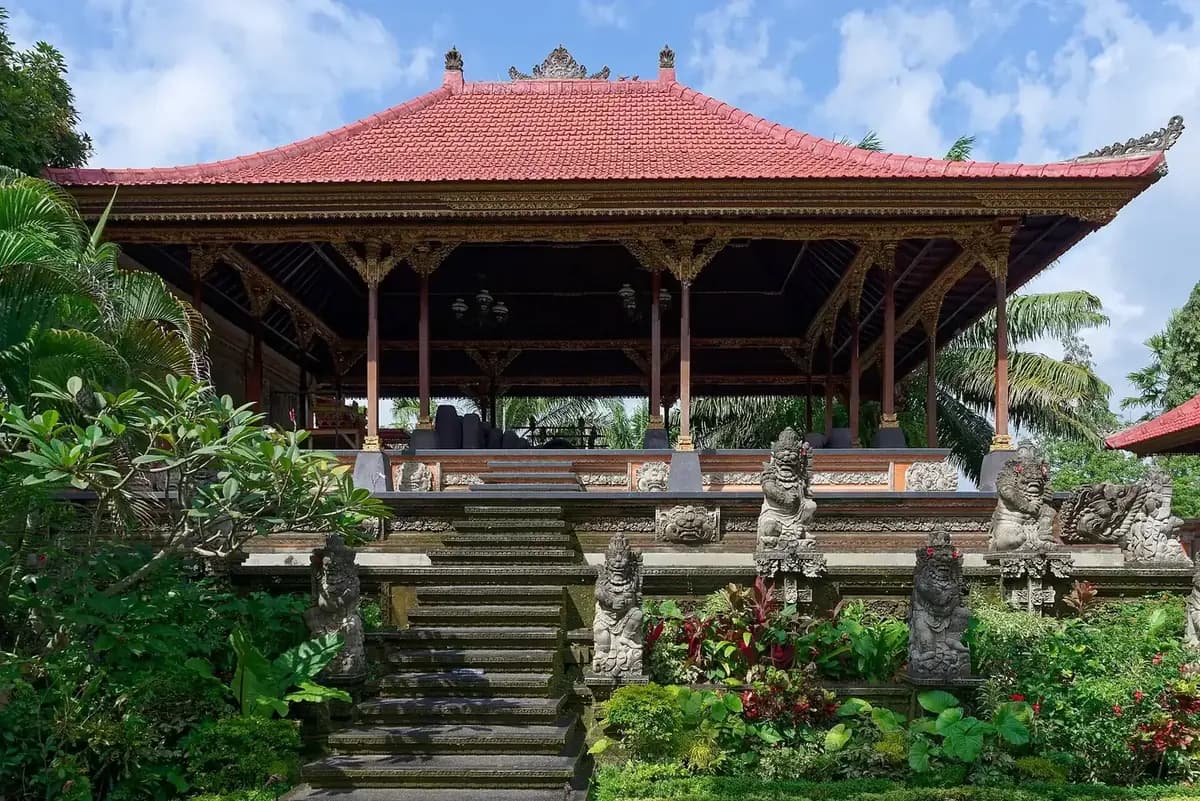
Ubud Palace
Twenty minutes by day, an evening dance performance by night.
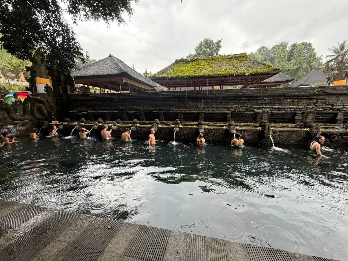
Tirta Empul
The purification spring on the same road north, best at opening.
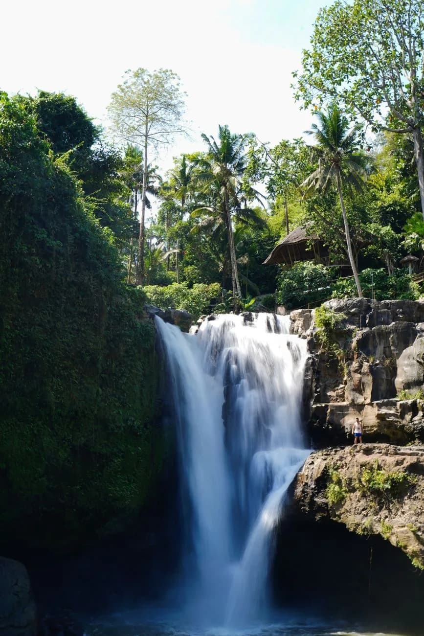
Tegenungan waterfall
The afternoon half of a full day out of Ubud.
Bali waterfalls
The three-in-one morning east of Ubud, and where you can swim.